
![Luberon [fr]](/images/version_francais.gif)
![Luberon [en]](/images/version_english.gif)
Saignon
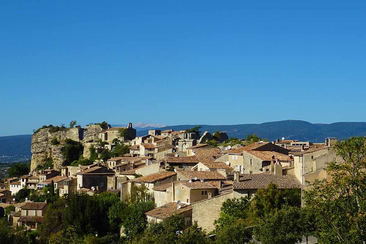
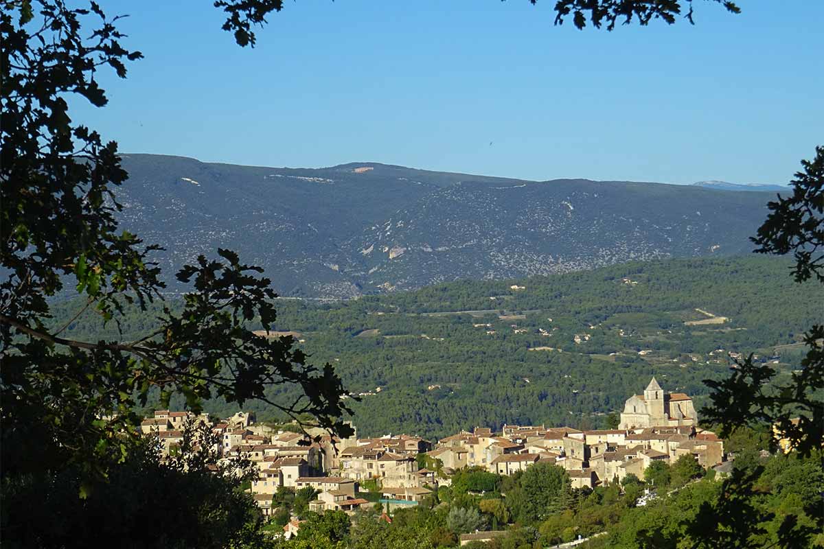
Above the city of Apt and the Calavon Valley, the Bellevue Rock appears as a formidable lookout, which seems from a distance like a colossal fortress, resplendent when the sun's rays illuminate it at the end of the day. The village of Saignon clings to its rock hanging like a shell from its rock. The name of the village comes from its function as a sentinel, from the Latin signum to the Provençal sagniol and today Saignon. The promontory forms the western limit of the Claparèdes plateau, the other end of which is Bonnieux
The first remarkable inhabitants of the territory were rhinos, hyenas, chevrotains and other mammals that walked through a landscape of lagoons and lakes where they left their fossilized footprints about 30 million years ago during the Oligocene period. The landscape changed a lot until the appearance of man who left archaeological traces in the Neolithic period. The Ligurians and Gauls built an oppidum on the privileged position of the Bellevue Rock. On the territory of Saignon were established two beautiful and rich Roman villas, including the "Palais des Fronton" a rich Gallo-Roman family in the 2nd century. On the site of the villa ruined during the barbarian invasions, the Abbey of Saint-Eusèbe was built. In the Middle Ages the rock was occupied by three castles, called Château du Rocher, Château Méjean (from the middle) also called Tortamolles and Château Crugières, they belonged to three different families who shared the suzerainty over the village. A quarrel between co-lords led to the destruction of Château Méjean. In return for serving as sentinel for Apt, the village received franchises and privileges that allowed it to prosper, as evidenced by the architecture of the houses in the old village.
Visit of the Village
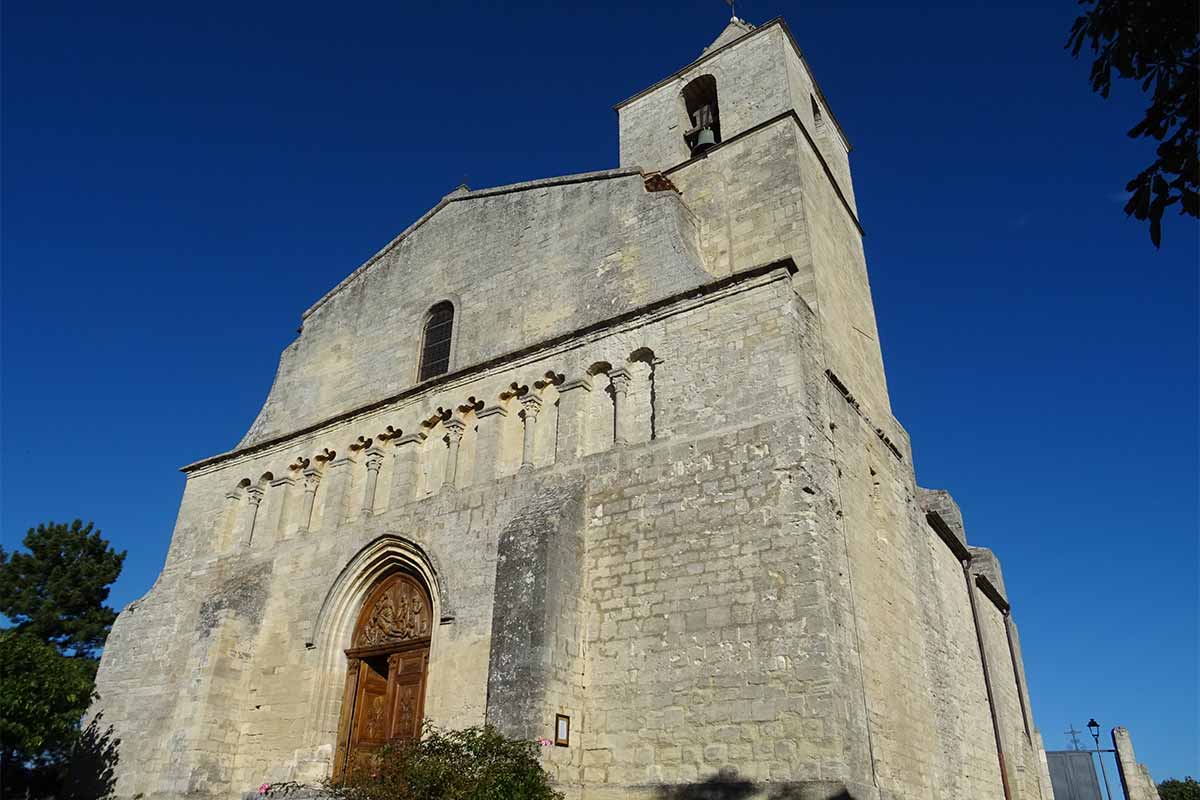
The church of Our Lady of the Holy Cross is built outside the village walls. It is an 11th century Romanesque building, overhung by a square tower, its robust appearance is enhanced by the buttresses, its façade was redesigned in the 16th century. It was a compulsory stopover for pilgrims on their way to Santiago de Compostela via the Via Domitia, it houses a relic of the Holy Cross.
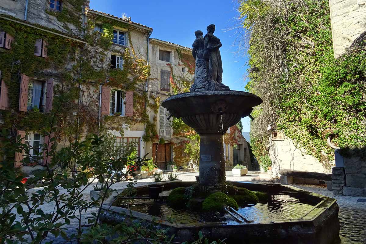
The Place de la Fontaine is the centre of the village, with a beautiful fountain surmounted by a double allegorical statue of the Agriculture and Industry. It is a work of the Aptesian sculptor Joseph Noël Elzéar Sollier. Under a double arcade is the washhouse, once an important place of social interaction for the inhabitants.
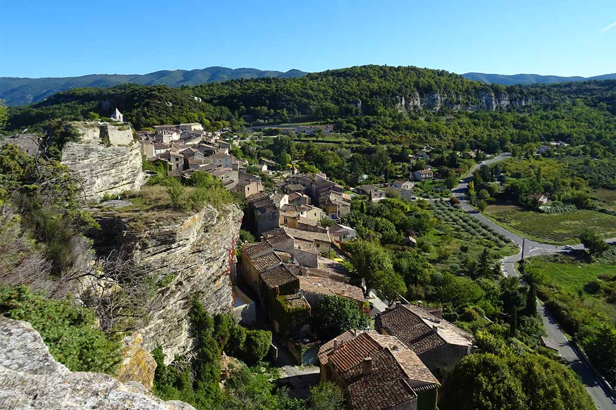
After a medieval gate and the remains of a castle, the Saint-Jean chapel is located under the fortress at the foot of the Rock. At the end of the village, a stone staircase leads to the top of the rock 30 metres above the village roofs and 200 metres above Apt. We can see the Mourre Nègre (summit of the Luberon), the summits of the Mont Ventoux and the Montagne de Lure, the white peaks of the southern Alps to the east and sometimes when the weather is very clear, the Rocher des Doms in Avignon
 s
s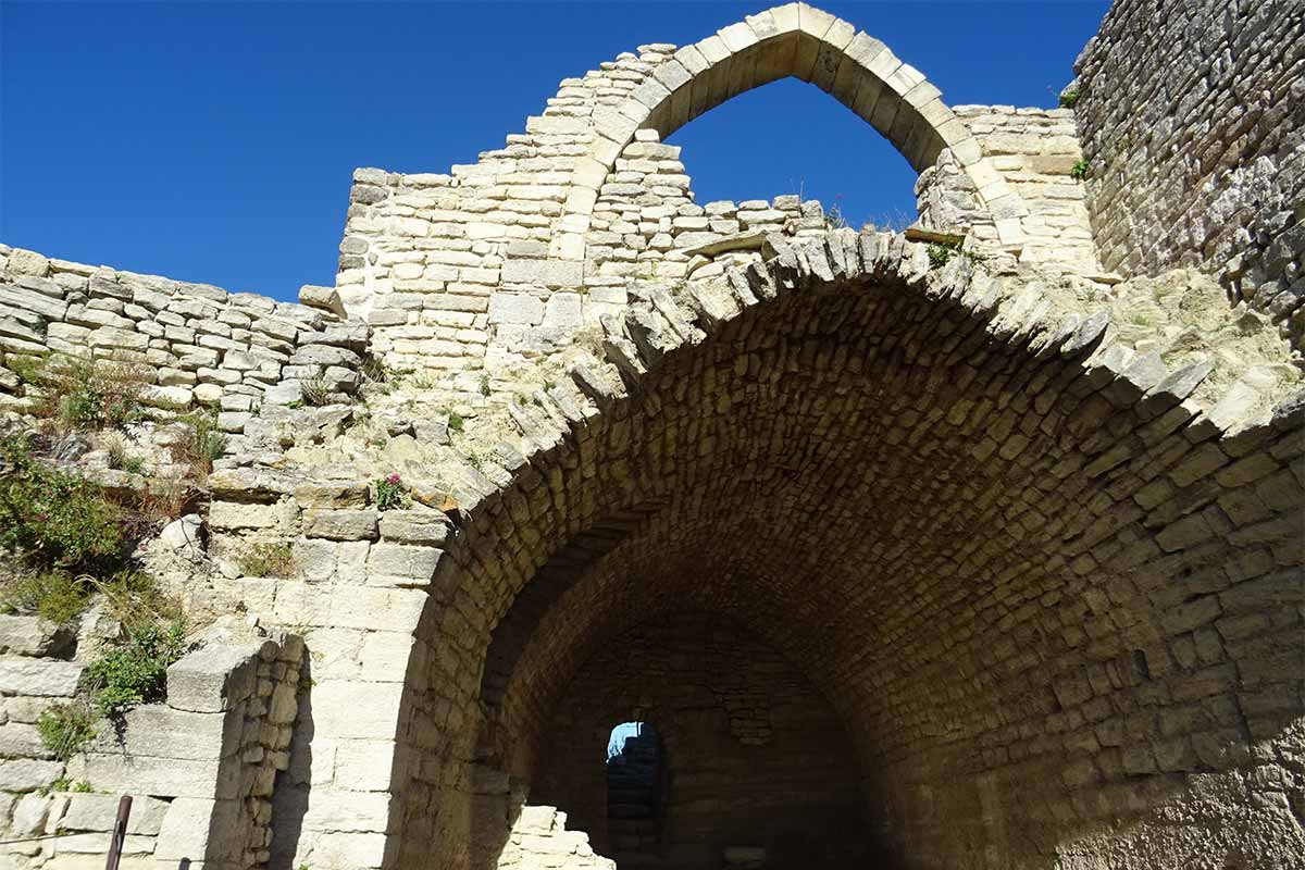
Visit Saignon in photos : slideshow
Saignon perched village in the Luberon
Place de la Fontaine in Saignon
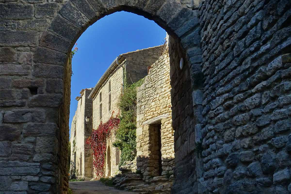
Porte de l'Auro (Wind gate), medieval gate in Saignon
View over Saignon and the Luberon from the top of the Rocher de Bellevue
Saignon medieval village in the Luberon
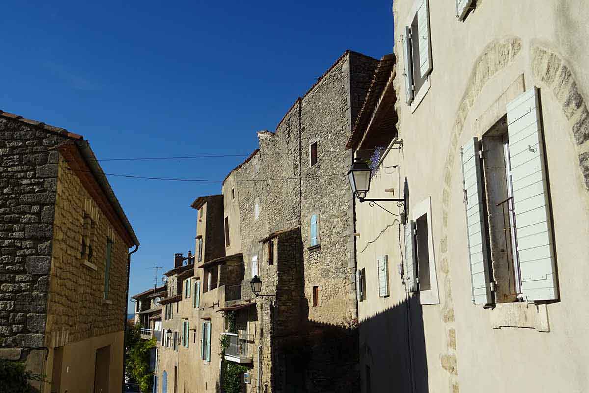
Street of Saignon village in the Luberon
Church Notre-Dame de la Sainte-Croix à Saignon
Saignon medieval village in the Luberon
Saignon perched village in the Luberon
Practical information and accommodation in Saignon and nearby
Selection of Bed and breakfast on the portal of Provence's B&B near Saignon.
To see and to do in Saignon :
- Romanesque church Notre-Dame-de-la-Sainte-Croix.
- Place de la Fontaine
- Ancient abbaye Saint-Eusèbe (private estate)
- Chapel Saint-Michel de Transi
- Bellevue Rock
- La Borie de Garuse
- BioLabyrinthus garden de Corinne Detroyat at the domaine de la Molière
- Weekly market "Marché Nature" in Saignon, Tursday morning from april to september, place du petit pasquier
- Festival François Morénas consacré au cinéma pendant l'été.
- Village Festival the 1st or 2nd week-en of August
- Music Festival le Son des Pierres
Coming to Saignon
GPS coordinates N 43°51'50'' - E 5°25'44''
Location of Saignon : altitude 450 metres, 1000 inhabitants, à 4 km from Apt, 10 km from Caseneuve, 16 km from Bonnieux, 16km from Céreste, 58 km from Avignon, 59 km from Aix-en-Provence.