
![Luberon [fr]](/images/version_francais.gif)
![Luberon [en]](/images/version_english.gif)
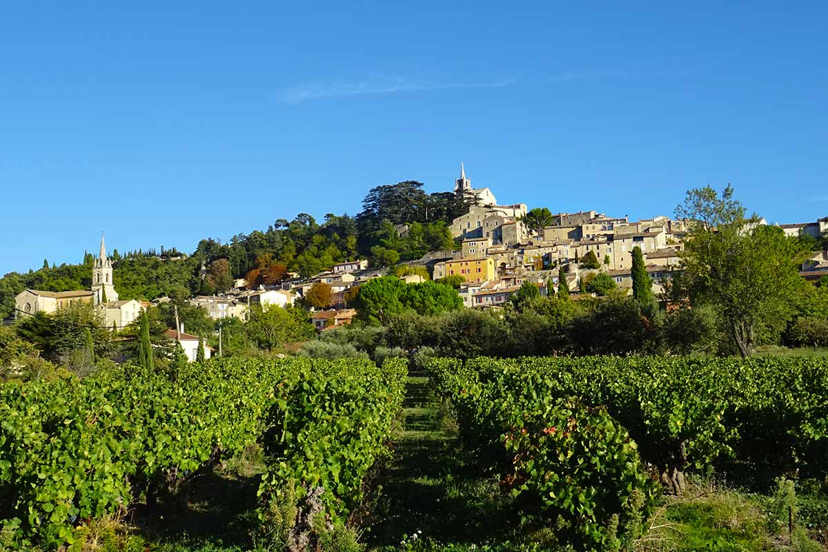
Bonnieux village in the Luberon
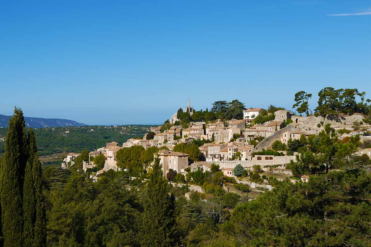
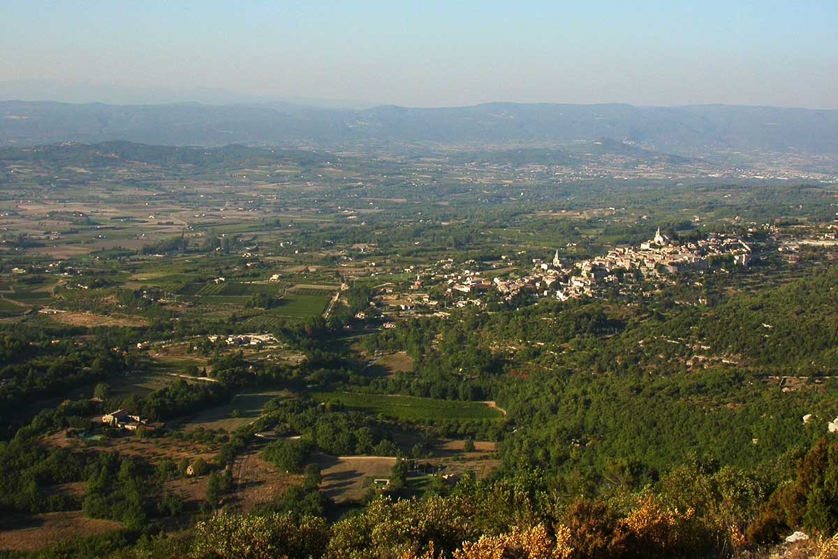
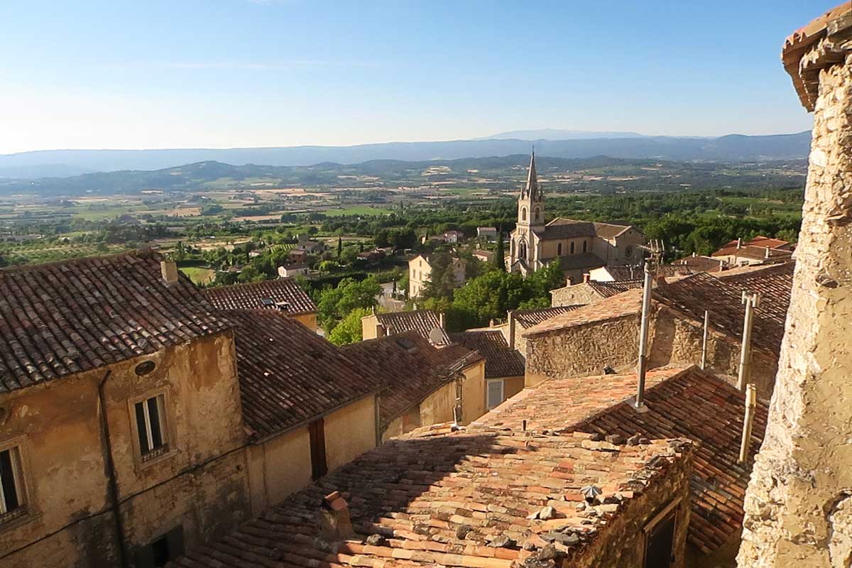
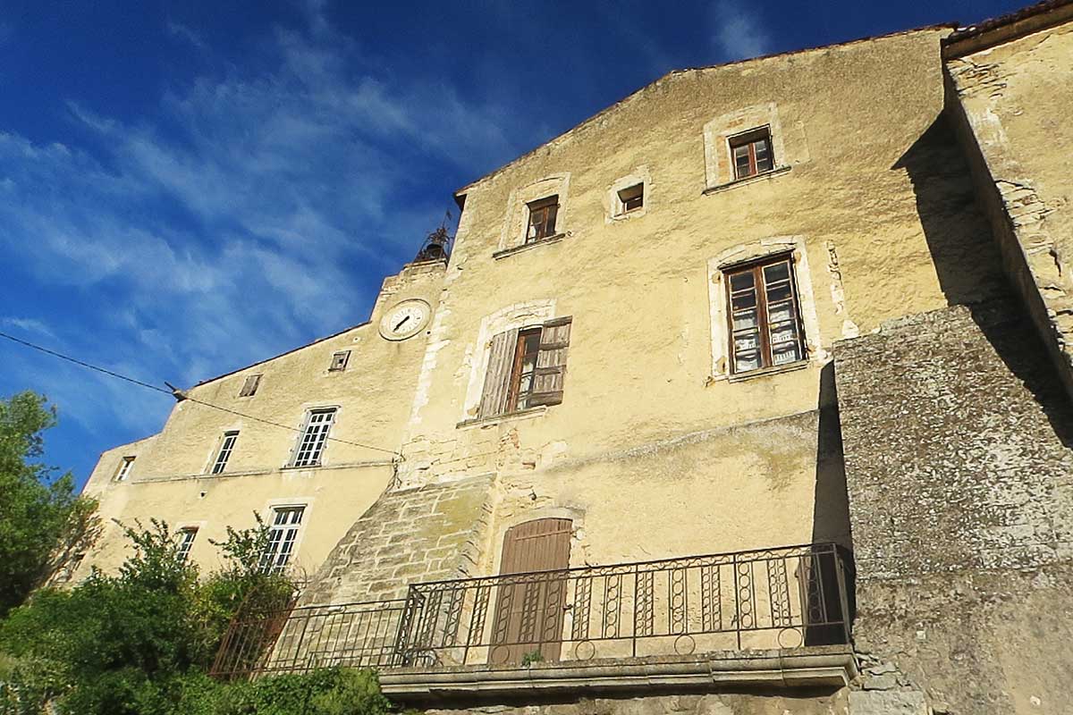
Bonnieux is one of the most famous villages in the Luberon. Bonnieux is built on the northern slope of the Luberon. At the foot of the village to the north lies the Calavon valley bordered by the Monts de Vaucluse, in the middle of which can be seen the Roussillon hill and its ochres. Bonnieux faces the village of Lacoste, its twin brother, the two villages seem to be staring at each other.
The village of Bonnieux is located at the entrance at the junction between the Petit Luberon and the Grand Luberon. Through Bonnieux passes the only road that connects the northern slope to the southern slope of the massif to reach the village of Lourmarin.
History of Bonnieux
The human presence on the territory of Bonnieux is very old, since traces of periodic occupations by Neanderthal man have been found in the shelter of the Combette bridge between 50,000 and 60,000 years ago. Remains of Gallo-Roman villas have been found in the plain below the village, near the Via domitia, an important Roman road linking Italy and Spain, of which the Julien Bridge is a structure. Bonnieux's name appears in the archives in 975 as Castrum Bonils, on the occasion of a donation. The village was established on the heights in the 13th and 14th centuries, around the "Castellas" a seigneurial castle built by the Agoult , a powerful Provençal family. In 1274, Bonnieux was integrated into the pontifical domain, but remained an enclave in the lands of the Count of Provence, it remained papal land until the Revolution. Bonnieux is a Catholic village during the Wars of Religion that ravaged the region. Then comes the time of prosperity: in the 18th century, Bonnieux was an active city of 3500 inhabitants, the medieval village was transformed to take its present appearance. At the end of the 19th century, there were 18 bistros, six gambling rooms and two brothels!
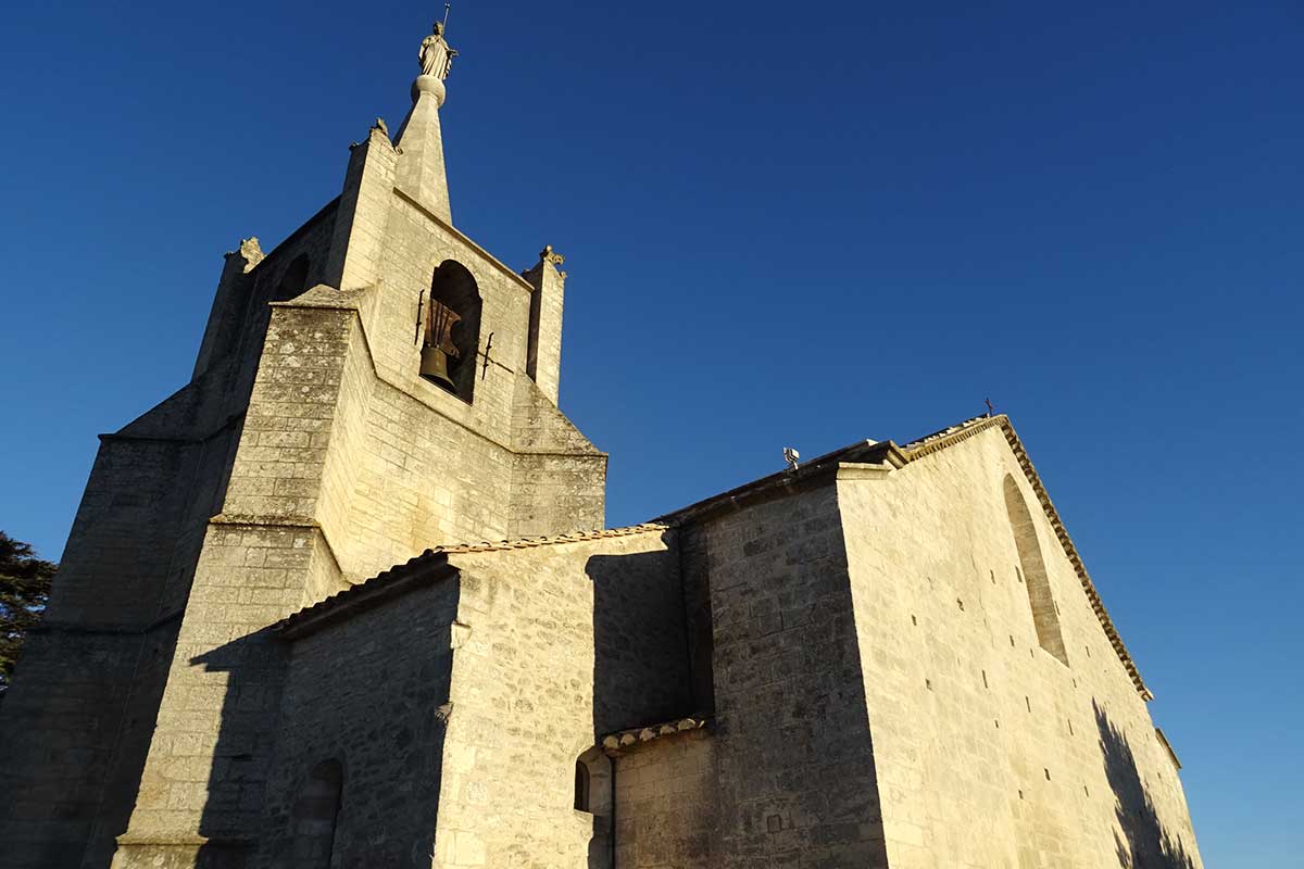
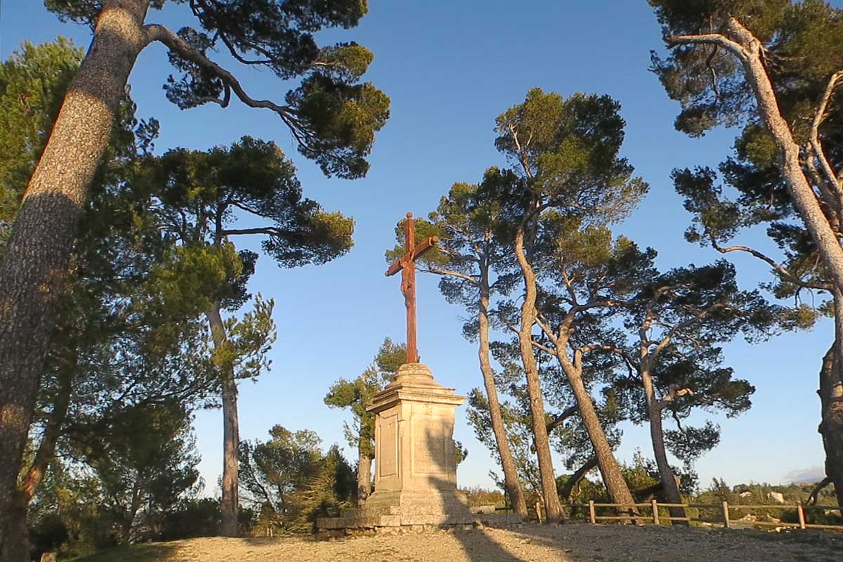
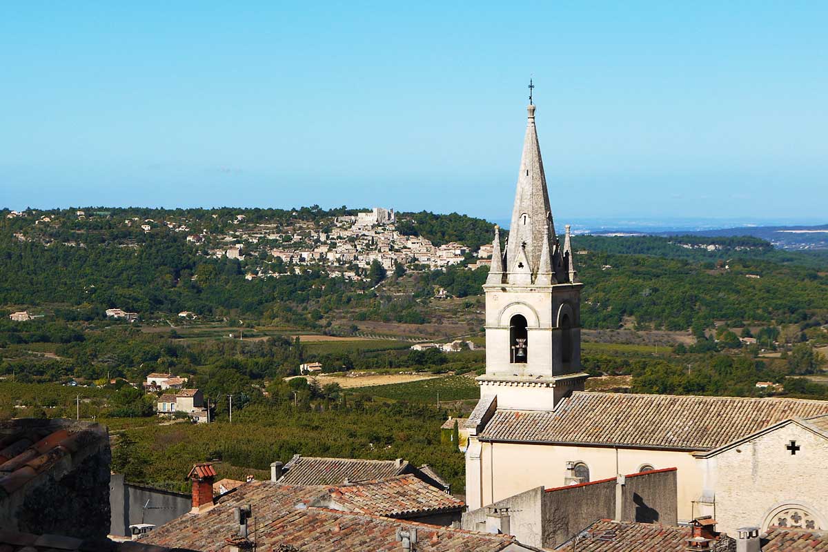
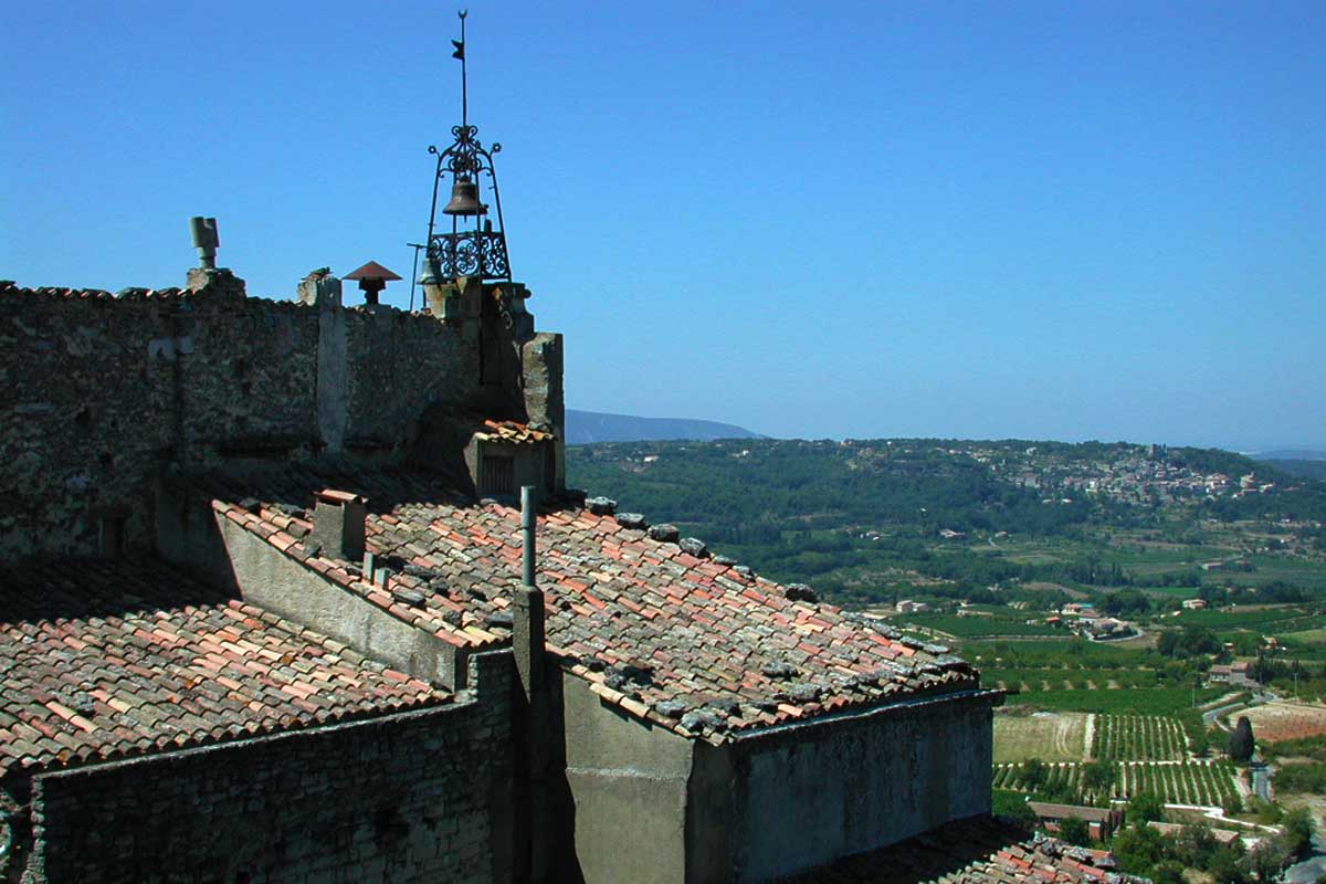
The silhouette of the Upper Church (or Old Church) stands out at the top of the village at an altitude of 429 metres. It is from the 12th century, then was redesigned in the 14th century, and further enlarged in the 16th, 17th and 18th centuries. Nevertheless, it retains a remarkable visual unity. Behind the Upper Church, an esplanade planted with cedars and majestic pines in front of a magnificent landscape dedicate this place to rest and meditation. This is the place where Castellas was located, the feudal castle around which the village developed in the Middle Ages. The inhabitants also lacked space and built cellars, mills and silos in the rock. Thus a house on the rue de la République has 14 cave cellars and a discreet exit located 30 metres below the building at the foot of the ramparts.
Bonnieux is home to some very beautiful castles and bastides, centres of agricultural and wine-growing life, many of which have now been converted into private homes or guest houses.
The Julien Bridge, an ancient Roman bridge


The Julien Bridge is located in the plain a few kilometres from the village of Bonnieux. It is an ancient bridge, one of the best preserved in Roman Gaul. It crosses the Calavon, an intermittently flowing river, most of the time dry, but its flow can increase sharply during heavy autumn or spring rains.
The Julien Bridge is a civil engineering structure along the ancient Via Domitia, a major trade route linking Italy to Spain via southern Gaul. The construction of the Roman bridge was completed in 3 BC, its name comes from the Roman colony Apta Julia, the Roman name for the city of Apt, close to ten kilometers.
The piers of the Julien Bridge seem to have grown through the outcropping rocks in the riverbed. We can imagine them deeply rooted in the limestone soil. The holes contained bronze staples to connect the stone blocks and solidify the structure. They disappeared long ago and the perfectly adjusted blocks without mortar have stood the test of time and weather.
A new modern bridge was built in 2005 for vehicle traffic. After more than 2000 years of service, the Julien Bridge is now the attraction of many visitors on foot or by bicycle, who come to stop and admire the perfect equipment and elegance of this monument left by the Romans.
The Luberon Cedar Forest
The Cedar Forest is located above Bonnieux on the crest of the Petit Luberon, which rises to an altitude of 720 metres. In the 19th century, the high plateau of the Petit Luberon was degraded by the intensive grazing of sheep herds. In 1861 this area was sown with cedar seeds collected in the Algerian Middle Atlas. The Atlas cedar is a drought and fire resistant species, and has a long life span, sometimes several centuries. In 1952, during the great fire in the Petit Luberon, only the cedar forest was spared. Cedars like it, they reproduce and the forest extends from the 1920s to nowadays cover an area of 250 hectares. The original cedars are now venerable centenarians who impose by their majesty and provide beneficial shade in summer.
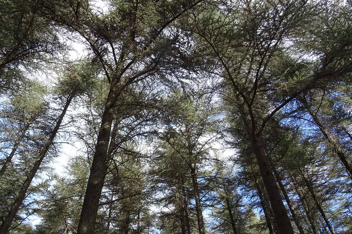
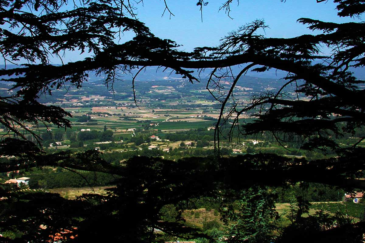
The view over Bonnieux and the Calavon valley is majestic. To the north, we can see the white summit of Mont Ventoux emerging behind the dark peaks of the Monts du Vaucluse. To the south, the view overlooks the Durance valley and leads to Mont Saint-Victoire. The Cedar Forest is a popular family walk. A 3 km botanical trail, punctuated by information terminals, offers a pleasant and accessible walk for everyone, including people in wheelchairs. The Cedar Forest is classified in 2003 as a "Natura 2000" area to protect rare bird species such as the Egyptian vulture, Bonelli's eagle, golden eagle, eagle owl and blue monticulture. It was awarded the "Espace Naturel Sensible" label in 2013, which allows it to be adapted to welcome the public (nearly 35,000 visitors per year) and preserve the natural heritage. The Cedar Forest is managed by the Luberon Regional Natural Park.
On the road leading to the Cedar Forest car park, a curious 30-metre high isolated tower stands at the bend of a bend. It is the Philippe Tower, built at the end of the 19th century by Philippe Audibert, a talented sculptor who wanted to see the sea from his home. Philippe Audibert is the author of the statue of the Virgin Mary which was erected at the top of the Eglise Haute de Bonnieux in 1865.
Visit Bonnieux in photos : slideshow
Bonnieux village of the Luberon
Bonnieux, the valley of Calavon and the Mont Ventoux
Bonnieux from the Cedar Forest
Castellas esplanade in Bonnieux
View over Lacoste from Bonnieux
Bonnieux village of the Luberon
Bonnieux village of the Luberon
Eglise Haute (High Church) in Bonnieux
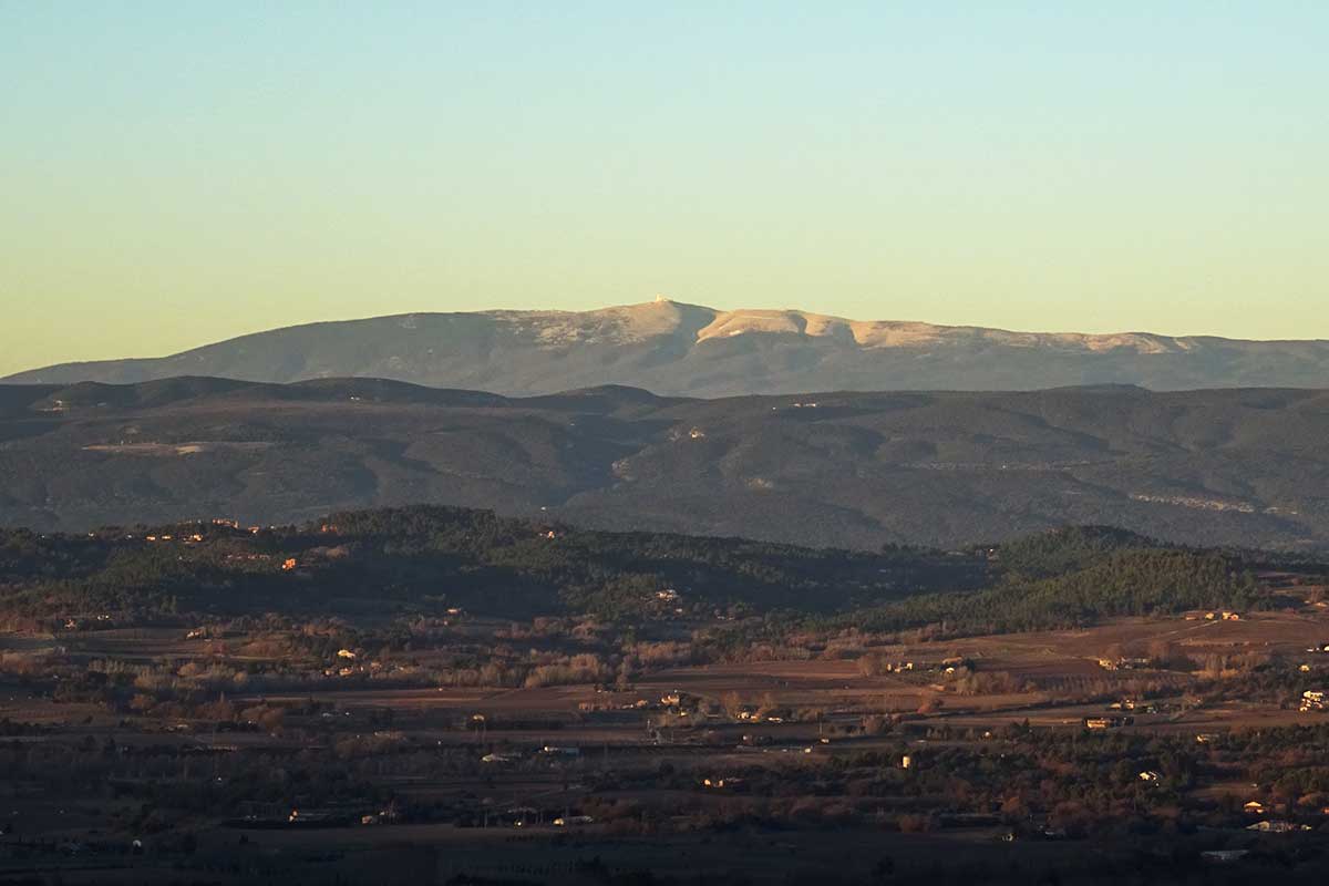
Mont Ventoux in winter from Bonnieux
Bonnieux village of the Luberon
the Pont Julien in Bonnieux
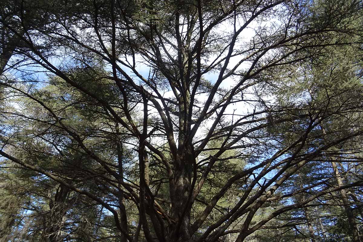
La Cedar Forest of Luberon
the Pont Julien in Bonnieux
La Cedar Forest of Luberon
View on the Calavon valley from the Castellas in Bonnieux
Information and accommodation in Bonnieux
Large choice of sélection de guest houses near Bonnieux in Luberon on the portal of the B&B in Provence
Activities and Sights
- High Church of the 12th century
- Pont Julien roman bridge
- Cedar Forest
- Votive Feast the third weekend of August
- Bakery Museum
- Fountains and wash-houses
- Weekly market on Friday morning place du Terrail
- City Garage Sale (Vide Grenier) - the day of the Feast of the Ascension
- Christmas crib in the High Church in December
- Enclos des Bories: about twenty dry stone huts on four hectares, near the Cedar Forest.
- The Claparèdes plateau: east of Bonnieux, it has many bories (dry stone huts)
- Running: Trail de la Cerise in June
- The Véloroute du Calavon takes the old railway line along the river, passing through Bonnieux Station and the Julien Bridge.
- Wines Vins Luberon AOC
Internet website of the village : bonnieux84.fr
Website of the tourist office: luberon-apt.fr
Website of the Parc du Luberon :parcduluberon.fr
Coming to Bonnieux
GPS coordinates : N 43°49'24'' - E 5° 18'29''
Location : altitude 360 meters above see level, 1400 inhabitants, à 5 miles from Lacoste, 8 km from Goult, 6 miles from Ménerbes, 6 miles Roussillon, 8 miles from Lourmarin, 9 miles from Apt, 10 miles from Saignon, 29 miles from Avignon
