
![Mont Ventoux [fr]](/images/version_francais.gif)
![Mont Ventoux [en]](/images/version_english.gif)
Sault, the village and its history
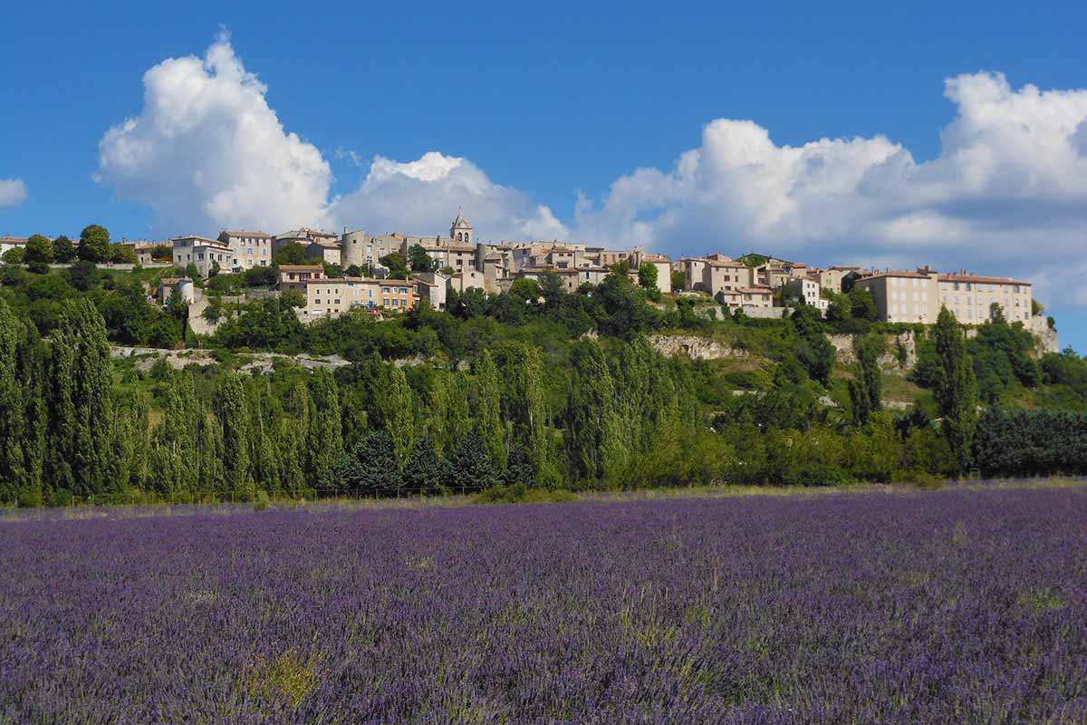
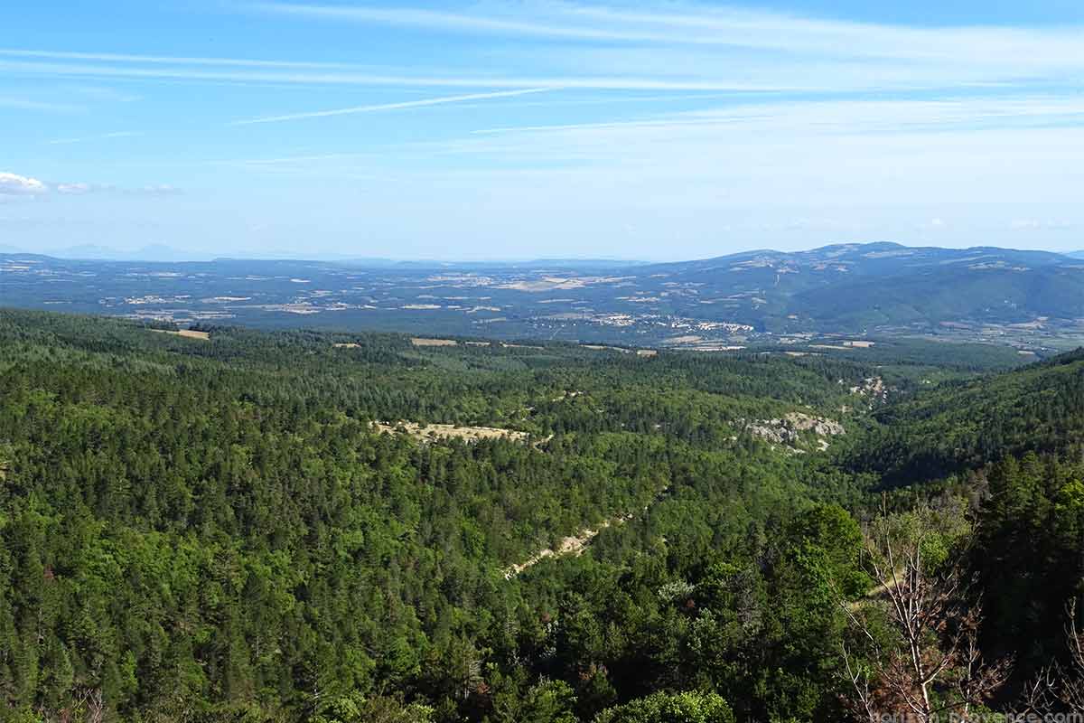
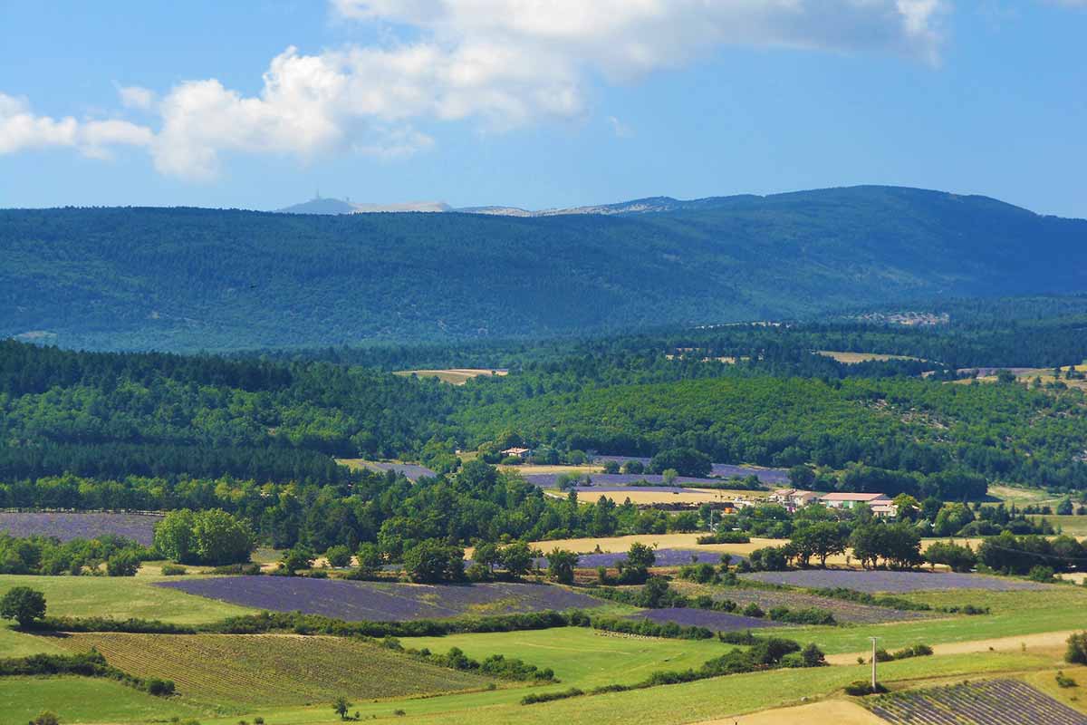
Sault is located in the heart of a preserved region, away from the main roads of communication: it is the authentic country of lavender which offers superb landscapes to contemplate and enchanting scents. Sault is located between Mont Ventoux and the Albion plateau, in the northeast of the Vaucluse department, on the border of the Provençal Drôme
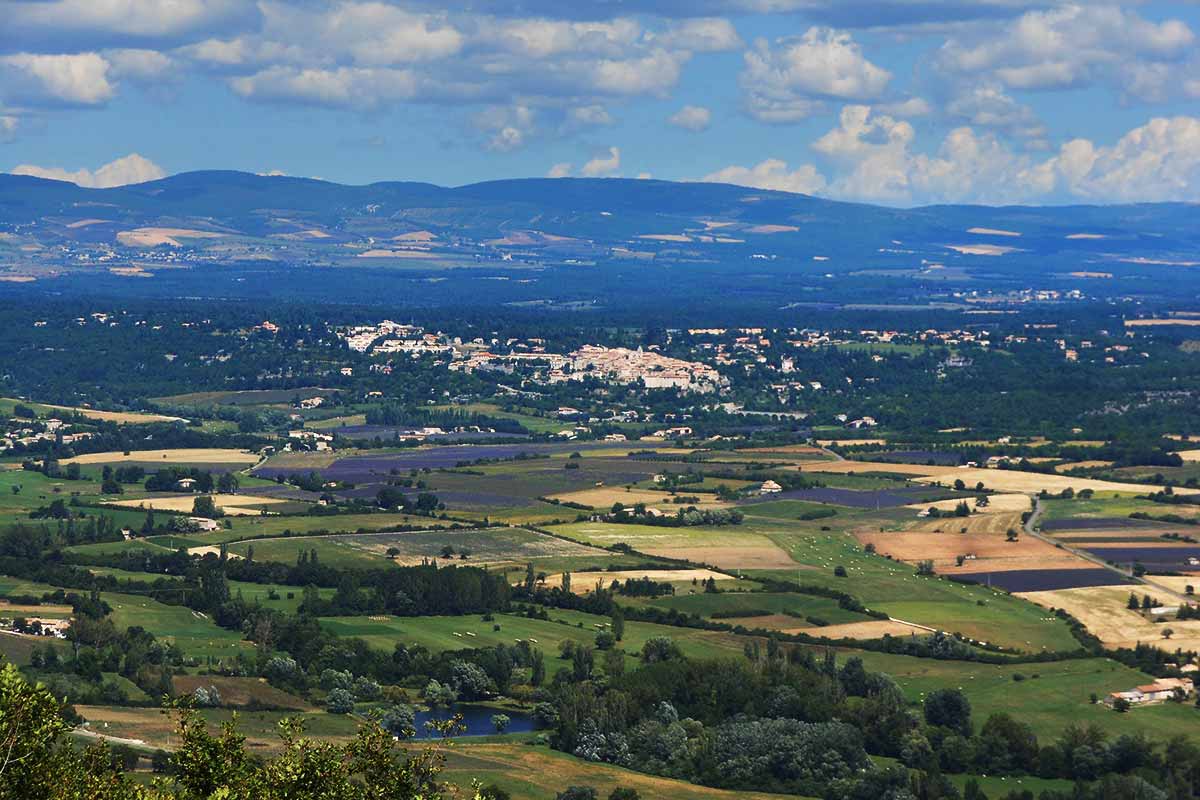
The small town is established on a prominent promontory of the Albion plateau opposite the eastern flank of Mont Ventoux, the houses dominate the plain below where alternating fields of golden wheat - the small épautre is cultivated - and the purple of the lavender fields. The region is an ideal place to walk and hike for lovers of nature and aromatic scents, and for the most sporty, a road climbs to Mont Ventoux via Chalet Reynard, it is the least difficult of the three.
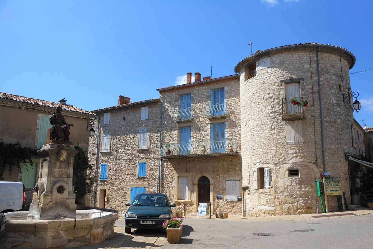
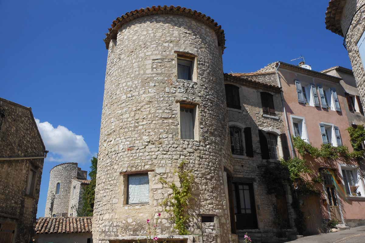
The German Emperor Henry II the lame handed over the barony of Sault and its valley to Agoult de Loup, in gratitude for his services. Sault became the fiefdom of the house of Agoult, a large noble Provençal family. There is little left of feudal times in the architecture of the city: the castle was included in later constructions. At the corner of the streets of the old city, we notice the rounded bulge of the feudal towers of the Château des Agoult.
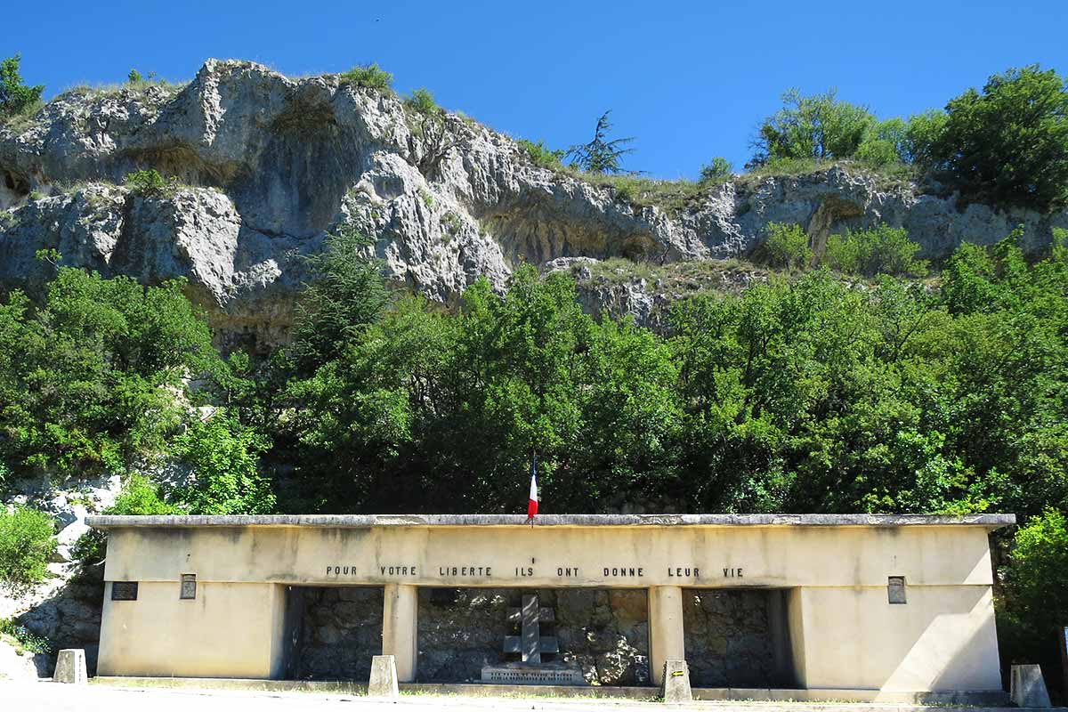
During the Second World War, the Sault region was the very active focus of a resistance movement against the Nazi occupier. The Maquis Ventoux collected many STO refractories, housed in the surrounding farms, hidden as farm workers. The FFI fought hard in 1944 in the region, the city of Sault suffered reprisals from the occupier, houses were destroyed and residents arrested, some deported to Germany. A Maquis Ventoux memorial is located at the foot of the city.
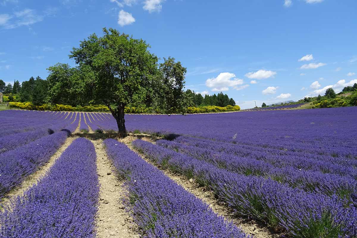
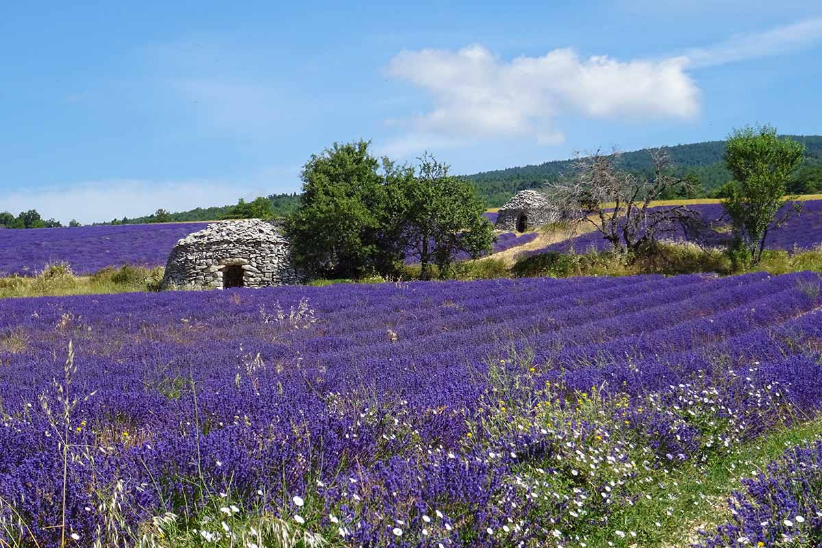
Lavender in Sault's countryside
"Lavender is the soul of Haute Provence" wrote Jean Giono.
Lavender is a rustic aromatic plant that was harvested by shepherds and some farmers on the heights of Mont-Ventoux or the Albion plateau. It is still found along the roads, at an altitude of 800 metres from June to mid-August. It was in the 19th century with the development of perfumeries in Grasse that the demand for lavender increased and that farmers began to cultivate this plant.
The Lavender officinale or Fine Lavender grows above 800 meters, it is reserved for the manufacture of essential oils. It is the one found in the Sault area. Lavandin is a hybrid between aspic lavender and fine mavender, it is cultivated between 200m and 800m, in the Provençal Drôme or on the Valensole plateau. Its yield is much better than fine lavender, its flower more abundant, and its color is more intense, but its scent is less fine, it is used in household products.
Lavender has become the symbol of Provence, and a major tourist asset for the Sault region. The great Lavender Festival on August 15 is a must-attend event where lovers from all over the world come together to enjoy this exhilarating aromatic plant. A lavender festival is also held on the 1st Sunday of July in the village of Ferrassières, 10 km from Sault on the Albion plateau.
The "Chemin des Lavandes" from Sault (5.5 km loop) brings you to explore lavender fields, discover distilleries and contemplate postcard landscapes.
Cycling the Mont Ventoux from Sault
The ascent of Mont Ventoux from Sault is considered less difficult than by Bédoin or Malaucène. The D164 road starts at the foot of the village (719 metres above sea level), it is 26 kilometres long, with a difference in altitude of 1150 metres and an average slope of 4.6%. The road rises through lavender fields and then enters the forest. Over the first 12 kilometres, the slope oscillates between 5 and 7% of inclination, it is a little long but not insurmountable for a trained cyclist. The chapel of Ventouret signals the passage of the 1000m of altitude.
Once past the 1200 metre sign, the next five kilometres are a fake, well-travelled climbing flat that allows you to gain speed and "put the plate on". The road offers some sumptuous views of the valley and the Mont du Vaucluse. It is from Chalet Reynard that things get more complicated, during the next 6 kilometres, the landscape is lunar the slope hardens to an average of 8% and if the wind is present, the conditions can become very difficult, even dangerous if the mistral blows hard at the Col des Tempêtes (1840 metres above sea level). If there is less than one kilometre left before the summit, forces are still needed to overcome the most difficult passage with slopes at 11%.
The ascent of Mont-Ventoux by Sault is therefore recommended for cyclists who are sufficiently trained but who are a little afraid to attack the Giant of Provence. Nevertheless, you must manage your effort well and not leave too quickly to complete the challenge in good conditions.
Sault Nougat
Nougat de Sault is a confectionery that has earned its reputation among the most demanding gourmets. The Boyer nougaterie has existed for 130 years, it has been managed by several generations of Boyer since the great-grandfather Ernest in 1887. It is a traditional production made from local products: lavender honey and almonds. By mixing honey with egg white beaten into snow, we obtain white nougat, tender and melting, while black nougat, slightly caramelized is more crunchy and appreciated by purists. The Boyer nougaterie can be visited, and it also offers gourmet specialities: crunchy almonds from Provence, raisins and natural orange extract, calissons with almonds, candied melon and orange peels, cakes made with small épautre flour, old-fashioned marshmallows flavoured with fruit and rolled in icing sugar, Provencal macaroons with almonds from Provence and bitter almonds.
Sault and Lavenders in photos : slideshow
-
Sault country
-
Sault, lavender country in Provence
Panorama on the Mont Ventoux from Sault
-
Church Notre-Dame de la Tour in Sault
-
Sault, village in Provence, tower of the old castle of Agoult
-
Lavender in Sault country
-
Sault, village in Provence, tower of the old castle of Agoult
-
Maquis du Ventoux Memorial in Sault
-
de Lavender field near Sault
Accommodation and practical informations
 Great
selection of guest houses near Sault and the Plateau d'Albion
Great
selection of guest houses near Sault and the Plateau d'Albion
Sault's tourist office website : www.ventoux-sud.com
What to see and what to do in Sault :
- The old town with houses with Renaissance facades
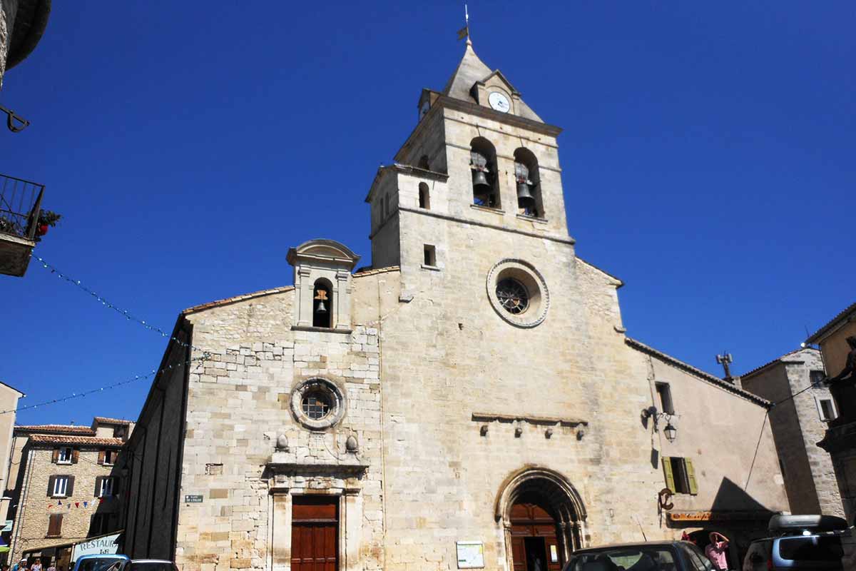
- Église Notre-Dame-de-la-Tour also known as Église Saint-Sauveur
- Maquis du Ventoux Memorial
- Weekly market on Wednesday mornings
- Lavender Festival on August 15th: fetedelalavande.fr
- Caving explorations in the caves: Trou de l'Ermite, Bouffard Avenue, Cougnoux Avenue, Meynière Avenue and Jean Nouveau Avenue.
- Walking and mountain bike rides on the Albion plateau towards Mont Ventoux and the Monts du Vaucluse.
- Sault City Museum: a museum like a curiosity cabinet made up of an eclectic collection and paintings by the local painter Evariste de Velernes. Open in July and August
- Nougaterie Boyer: nougat-boyer.fr
- Visits to lavender distilleries (by the Tourist Office)
Coming to Sault
GPS coordinates 44°05'31'' N - 5°24'32'' E
Location : 760 meters above sea level, 1400 inhabitants, 6 miles from belvedere of the Nesque gorge, 8 miles from Montbrun-les-bains, 17 miles from Banon, 19 miles from Apt, 15 miles from the summit of Mont-Ventoux, 24 miles from Carpentras, 41 miles from Avignon.