
![Mont Ventoux [fr]](/images/version_francais.gif)
![Mont Ventoux [en]](/images/version_english.gif)
The Nesque Gorge
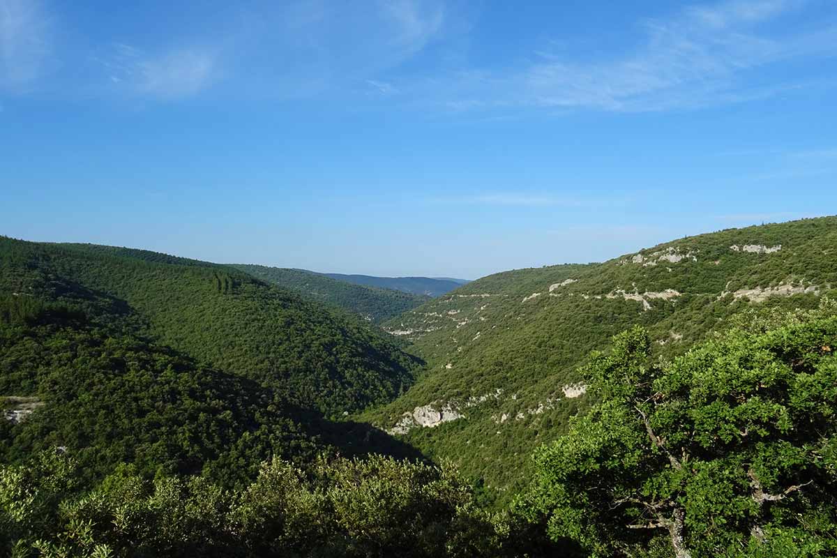
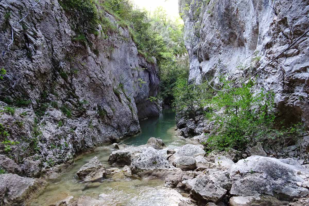
The Gorges de la Nesque are a spectacular canyon several hundred metres deep, which cuts through the Plateau du Vaucluse over a length of about 25 km, between the villages of Monieux upstream and Méthamis, at the foot of Mont Ventoux. The Nesque River rises near Aurel, discreetly crosses the Sault plain to Lake du Bourguet in Monieux before sinking into the Gorges that bear its name. The one who dug this deep canyon nevertheless appears as a modest river, reduced to a net almost dry in summer but which can turn into a furious torrent after violent showers in which the Provençal climate is sometimes customary.
The cliffs are dotted with crevices and shelters under rocks called bau or balms in Provencal. Some of them were busy during prehistoric times. Le Bau de l'Aubesier is located in the vertical wall opposite the Belvedere, it has revealed many remains of the occupation by Neanderthal man between 200,000 years and 35,000 years ago. The climate was then much colder, the top of the plateau was a cold steppe, life was concentrated in the canyon. Our ancestors fed on elk, deer, horse, auroch, megaceros (a large deer that is now extinct) and woolly rhinos. During this ice age, the Nesque was fed in the spring by water from the melting of the ice that accumulated on the plateau in winter. She dug this canyon into the Urgonian limestone that forms the Monts du Vaucluse. The karstic massif is dotted with caves and cracks in which the water from the river is now lost to supply the Fontaine-de-Vaucluse.
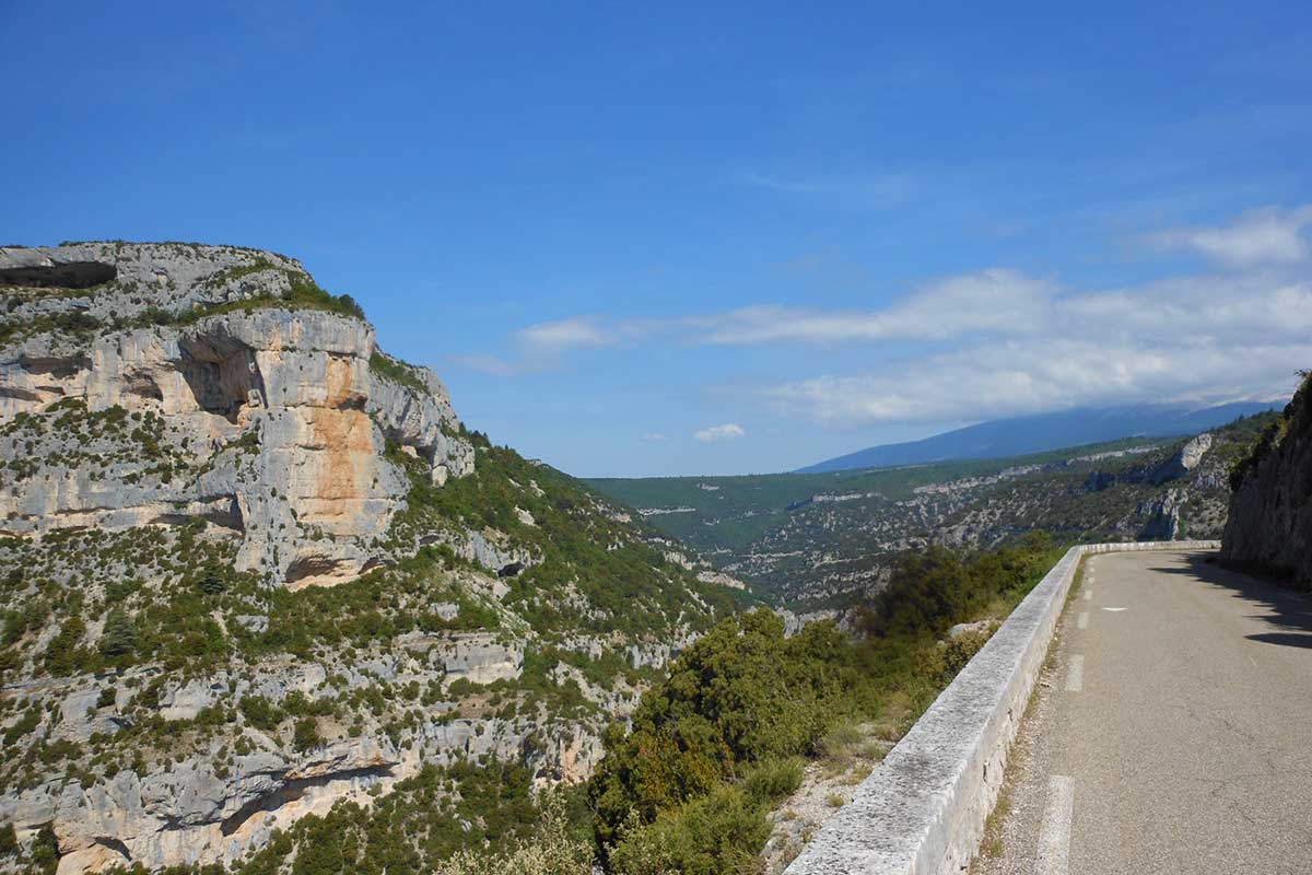
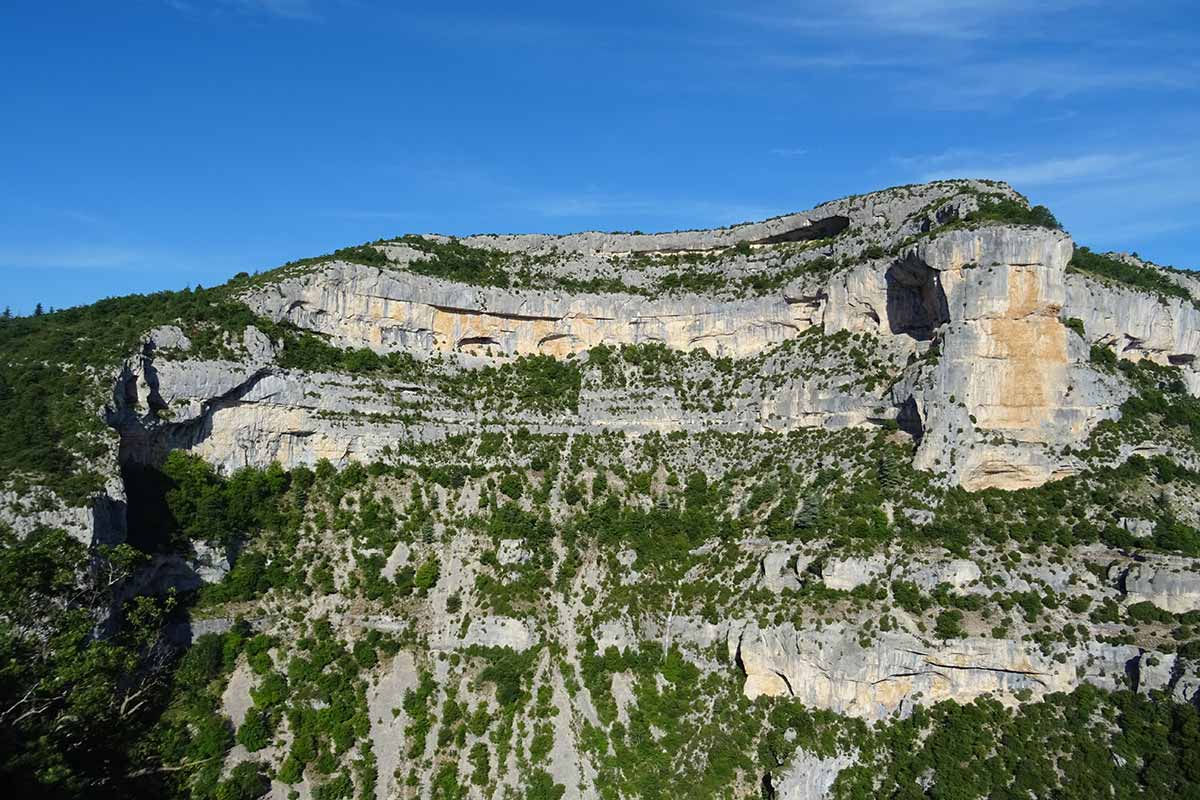
Castellaras Belvedere
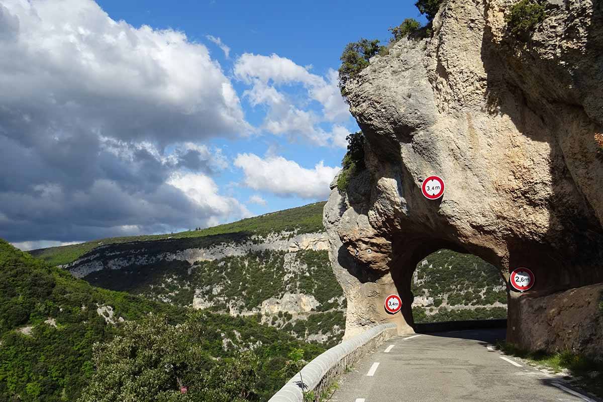
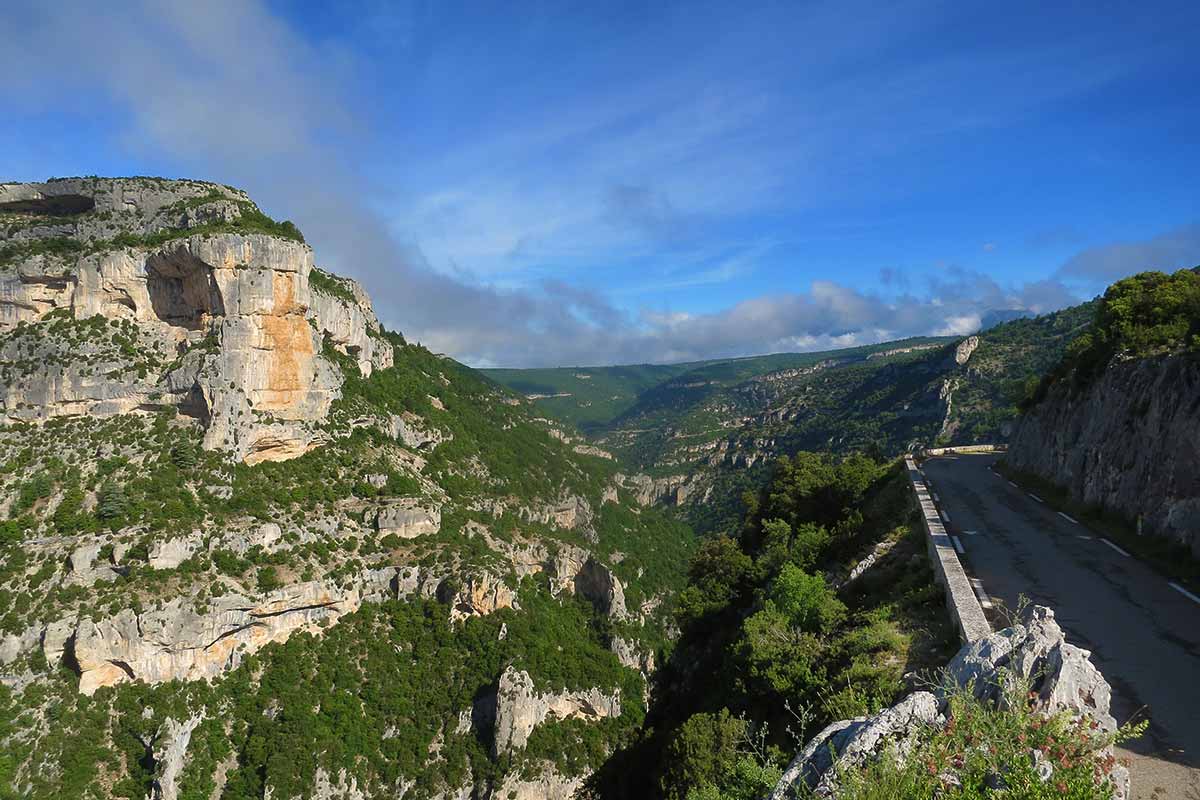
The D942 road runs along the Gorges de la Nesque, built as a corbelled road on the right bank, it follows the sinuous mountain contours and offers magnificent views over the landscape. Before its construction at the beginning of the 20th century, the high gorges of the Nesques were only served by roads and paths leading to the farms that were established on the plateau. The access roads linking the Comtat plain to the Val de Sault passed to the north through the Col des Abeilles or to the south through Méthamis and Saint-Hubert. It was first planned to follow the course of the Nesque, but the project chosen was to build a road halfway up, with a cornice and four tunnels.
The road is now very popular with cyclists and tourists. It rises gently from Villes-sur-Auzon to its summit, Castellaras (734m), where the viewpoint allows you to admire the Gorges and the "Rocher de Cire", so called because it was home to many swarms of wild bees. Frédéric Mistral made this magnificent place known, a stele is erected where the verses of the Provençal poet are inscribed.
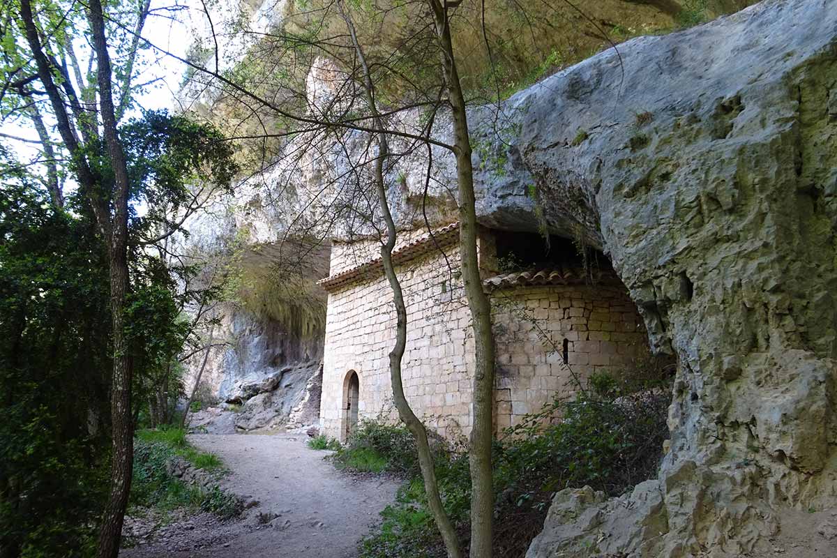
About 400 metres after the Castellaras lookout, towards Monieux, the GR9 long-distance hiking trail crosses the asphalted road, a steep path runs along the overhanging cliff to reach the bottom of the gorges where there is a chapel built in a rock shelter, the Saint-Michel chapel. An adjacent hermitage has now disappeared. The Saint-Michel chapel dates from the 12th century, the dilapidated building was restored in 1643 and was a place of pilgrimage until the 19th century.
La chapelle Saint-Michel chapel
The main access road to Sault is now the main road (D1) built above the Gorges in the 1960s when the nuclear base was installed on the Albion plateau. It passes through the Col de Abeilles (996m) where there is a modest chapel dedicated to Notre-Dame-de-Consolation. In this remote place lived Father Joseph Thouard (1825-1888), known as the "Good Priest of the Bees". A great connoisseur of plants, he provided care without requiring any fees, and his popularity was such that it is said that Emperor Napoleon III himself came to consult him. A stelle honours the memory of eight resistance fighters from Cavaillon, executed on 5 July 1944 in retaliation for heavy losses suffered by the German army against the Maquis Ventoux.
La Nesque Voie Verte (The Nesque Greenway)
On the first Sunday in June, on the occasion of the National Bike Day, the D942 road is closed to motorized vehicles, the Gorges de la Nesque are reserved for bicycles and "soft" modes of transport. It is an opportunity to enjoy the magnificent panoramas offered by the landscape. The road rises from Villes sur Auzon (284 metres above sea level) to Bélvédère (734 metres) with an average slope of 2.3%, never higher than 4%. The event is organized by the Syndicat mixte du Mont-Ventoux, with stands along the route. The objective is to raise awareness about forest fire prevention, information on cycling tourism, cycling routes around the Ventoux, the discovery of the Natura 2000 site, and a break from the freshness and flavours of the land (honey from the Rucher des Lavandières).
Nesque Gorge photos : slideshow
Gorges de la Nesque at the belvedere of the Castellaras
Gorges de la Nesque
Picturesque road in the Gorges de la Nesque
Gorges de la Nesque at the belvedere of the Castellaras
Gorges de la Nesque
Chapel Saint-Michel in the Gorges de la Nesque
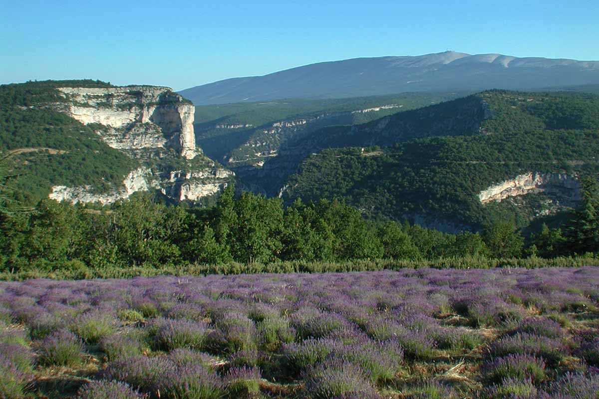
Gorges de la Nesque and the Mont Ventoux
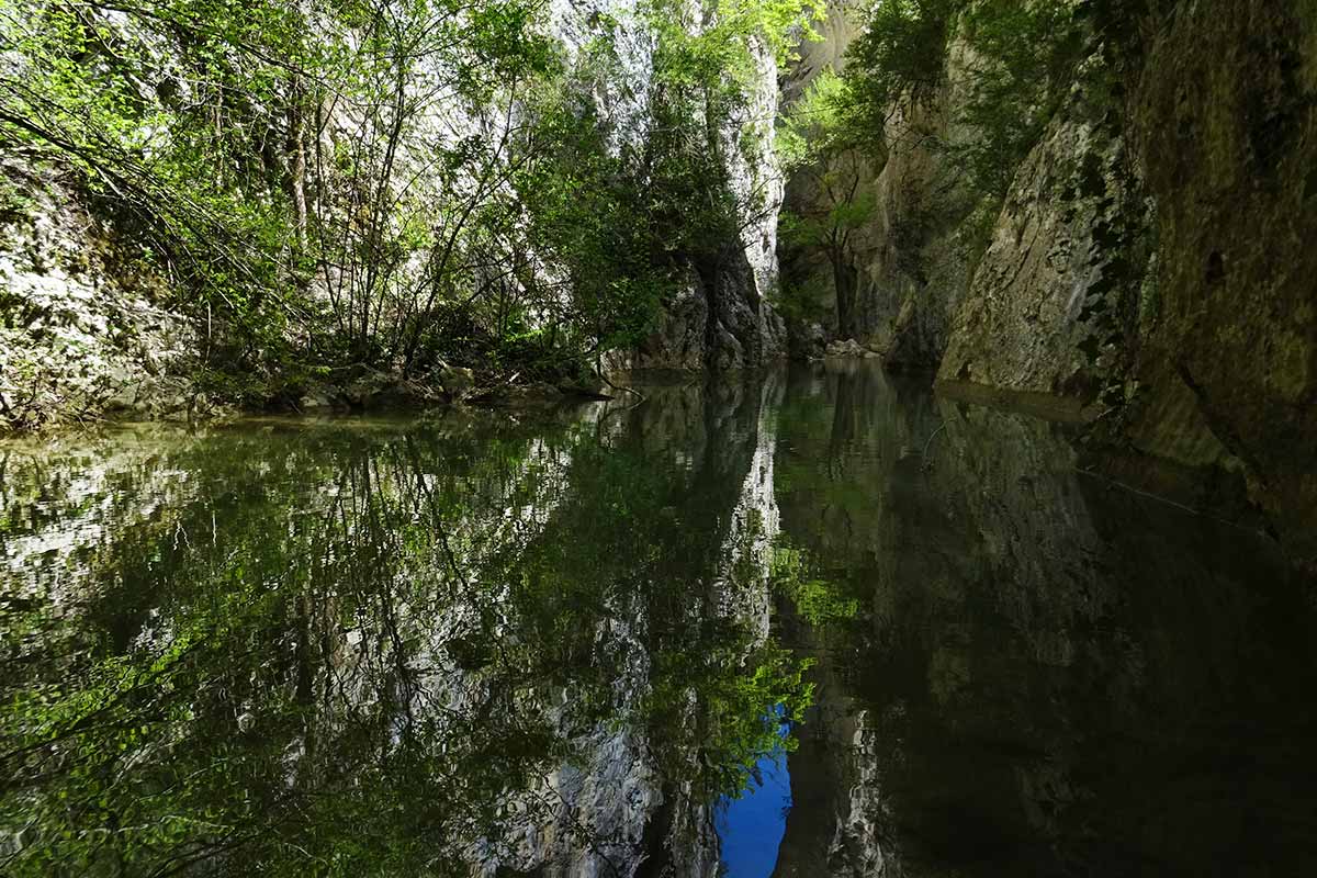
Nesque river in the Gorges de la Nesque
Nesque river in the Gorges de la Nesque
Practical informations and accommodation near the Nesque Gorge
Bed and breakfast near the Nesque gorge on the portal of Provence's guest houses
To see and do in the Gorges de la Nesque
- Walks at the bottom of the Gorges: superb hike but beware of the high level of difficulty, the path is very steep and some passages are corbelled. The path between the belvedere and the river is poorly marked.
- Half-marathon of the Gorges de la Nesque: from Ville-sur-Auzon to Monieux. It is organised by the Ventoux Sud community of municipalities. A bus service takes the runners back to their starting point. It takes place on the 1st Saturday in June.
- Nesque Voie Verte: the Gorges de la Nesque are closed to car traffic on the 1st Sunday in June, and are reserved for "soft mobility", bicycles and rollerblades.
- Trail des Terrasses du Ventoux: from Méthamis on the 1st Sunday in June, two 10 km and 22 km routes: trailterrassededuventoux.fr
- Trail of Hope from Lake Monieux in May: 21 km.
- The Grand Trail du Ventoux, 100km between Venasque and Gigondas passes through the Gorges de la Nesque. It takes place at the end of April: grandraidventoux.com
- Timed ascent of the Nesque: time trial by bike from Ville-sur-Auzon, 19.7 km for 444 m of positive altitude difference.
- Cyclo Ventoux Sud: Cyclosportive at the beginning of September from Malemort-du-Comtat, via the Gorges de la Nesque
- Cyclosportive Granfondo Mont Ventoux from Beaumes-de-Venise on the 1st weekend of June, the long route passes through the Gorges de la Nesque.
- Market on the shores of the Lac du Bourguet in Monieux on Sunday mornings from May to August
- Sale of Honey to the Rucher des Lavandières, at Joëlle and François Pihéry's, inhabitants of the Gorges de la Nesque in the old valance house (on road D942, in the combe du Puits Verrier)
Coming to the Nesque gorge (belvedere)
GPS coordinates 44°02'47'' N - 5°19'56'' E
Location : 734 meters above sea level, 2,5 miles from Monieux, 6 miles from Sault, 11 miles from Villes-sur-Auzon, 22 miles from Carpentras, 38 miles from Avignon.